Traffic & Safety at Gibraltar Corner
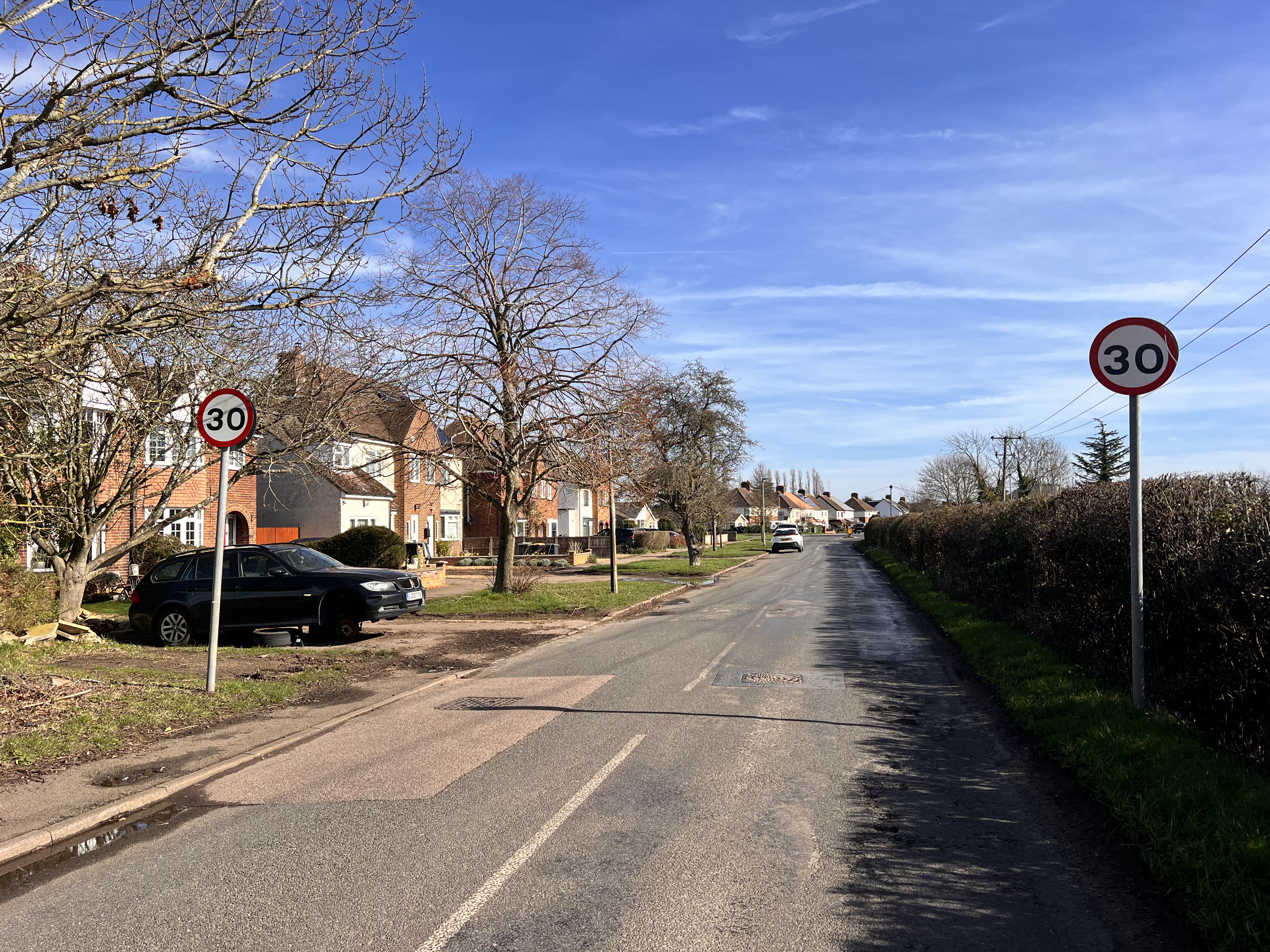
All traffic from 420 homes would feed into Gibraltar Corner, the crossroads connecting Wood End Lane, Green End Road, Home Road, and Ridge Road.
Ridge Road links directly to the bypass and into Wootton — which has already seen substantial expansion over the past decade.
420 homes could generate 700–900+ additional vehicle movements per day.
Key Highway Concerns:
- • Increased congestion at a rural crossroads
- • Turning conflicts & visibility constraints
- • Construction HGV movements
- • School-run peak pressure
- • Rat-running through rural lanes
Planning policy allows refusal where highway impacts would be severe. This junction is already constrained.
Disproportionate Scale
Kempston Rural has no shop, no pub, no GP surgery, no secondary school, limited public transport, and no defined village centre.
Adding 420 homes to a base of around 225 is not organic growth — it is structural transformation. Development must be sustainable in location and scale. This location is entirely car-dependent and infrastructure-light.
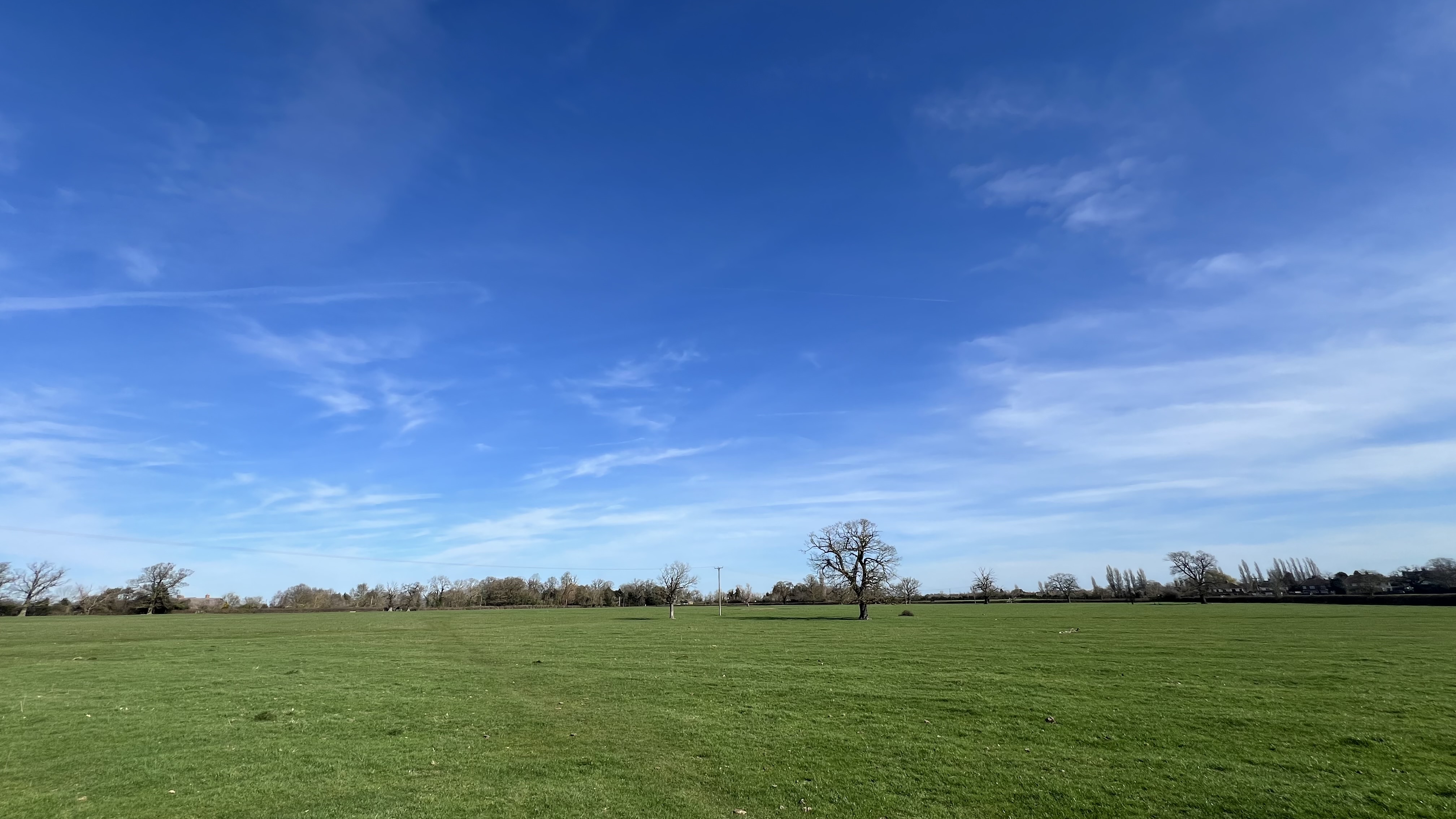
Loss of Rural Character
Kempston Rural is defined by open views, agricultural land, and clear separation between settlement clusters. This development would:
- ✓ Remove vital green buffer land
- ✓ Urbanise a rural landscape
- ✓ Fundamentally alter the area's character
- ✓ Create estate-scale expansion in open countryside
This is not modest growth. It is a settlement-trebling expansion.
Flood Risk & Drainage
The site is currently highly permeable agricultural land. Development would introduce massive amounts of roads, hardstanding, and roof area — vastly increasing surface water runoff.
Severe Local Concerns:
- • Rural ditch capacity
- • Downstream pooling
- • Maintenance of proposed SuDS
- • Long-term adoption responsibility
Flood risk must be fully assessed before any decision is made.
Wildlife & Biodiversity
The fields and hedgerows act as vital wildlife corridors, habitat for birds and small mammals, and ecological buffers between developed areas.
Large-scale development would fragment and remove these habitats permanently. Biodiversity Net Gain must be measurable, enforceable, and long-term — not just theoretical promises.
Cumulative Development Pressure
Wootton has seen substantial housing growth in the last decade. Extensive development has already occurred around the Kempston bypass corridor.
Planning decisions must consider cumulative impact — not treat each application in isolation. This local area has already absorbed significant expansion. Enough is enough.
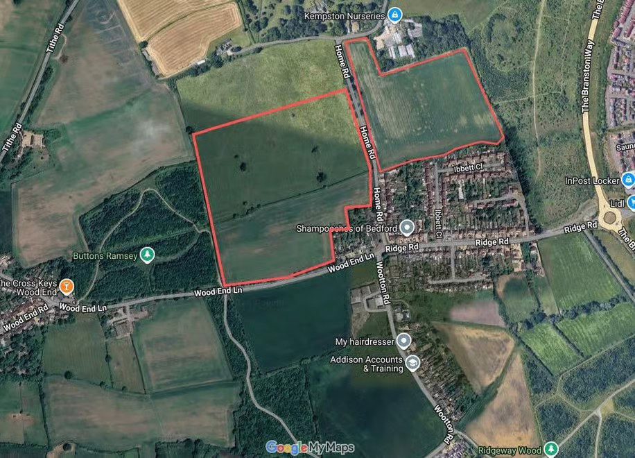
The Proposed Site
The highlighted area shows the agricultural land earmarked for 420 homes. This is the open countryside that currently provides the green buffer, natural drainage, and wildlife habitat described above.
Two applications refused. The fight continues.